Deselliers.ca
  • Home
  • Gallery
  • About
  • Contact
  • Blog
  • Events
  • Our Lakes : Connecting the Dots

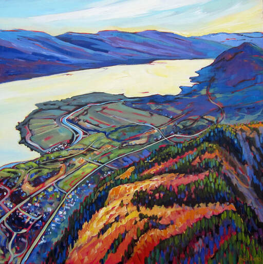
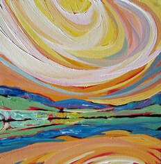
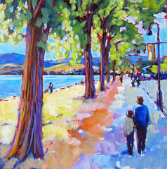
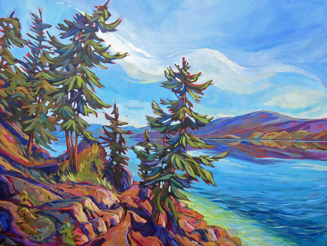
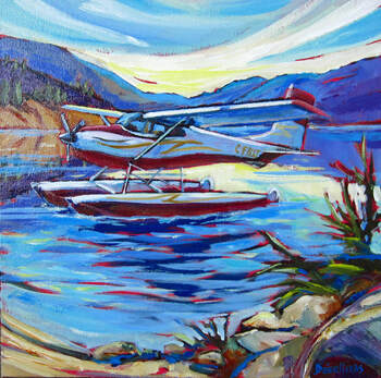
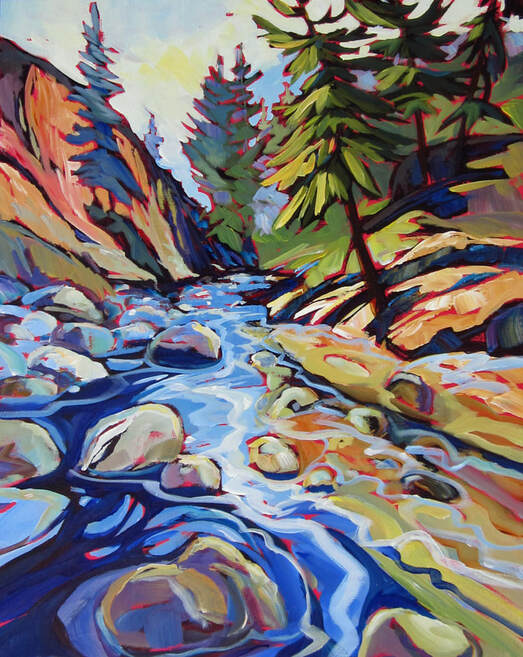
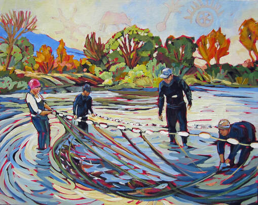
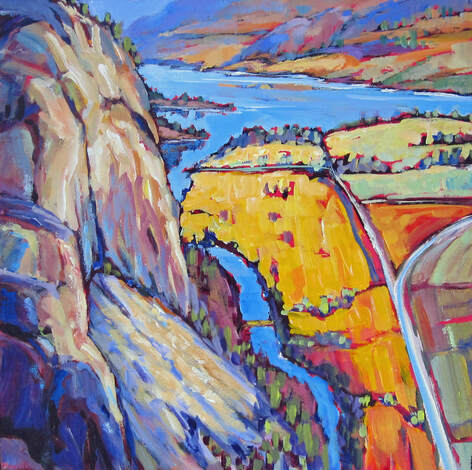
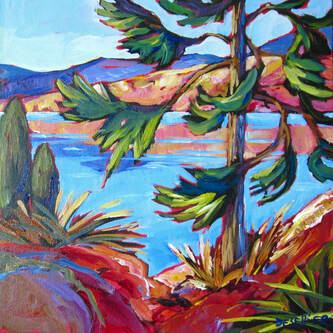
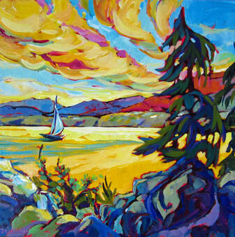
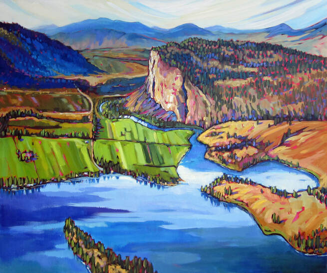
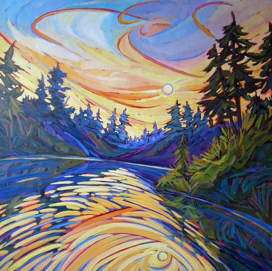
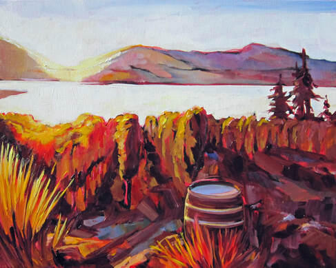
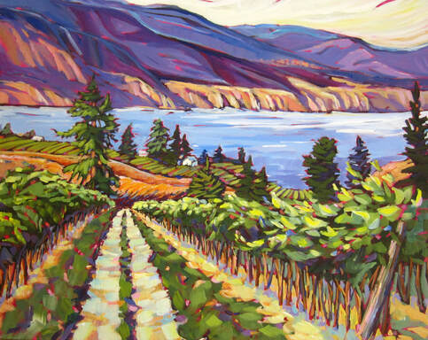
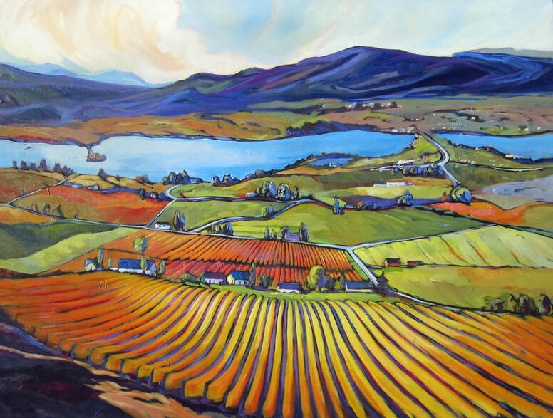
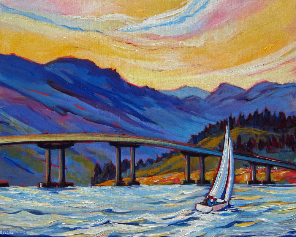
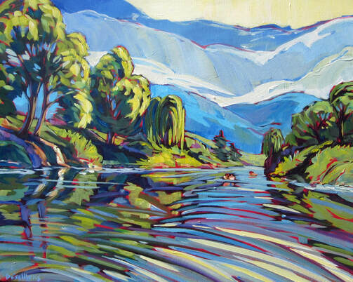
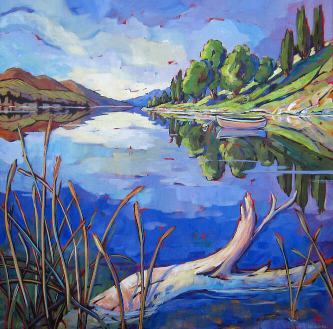
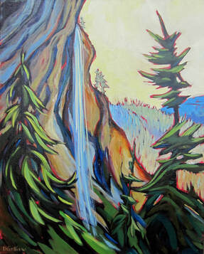
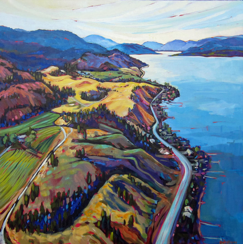
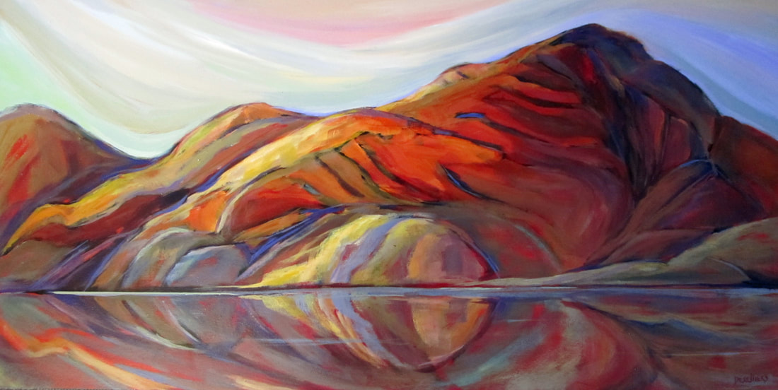
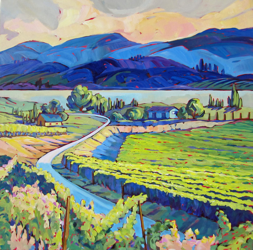
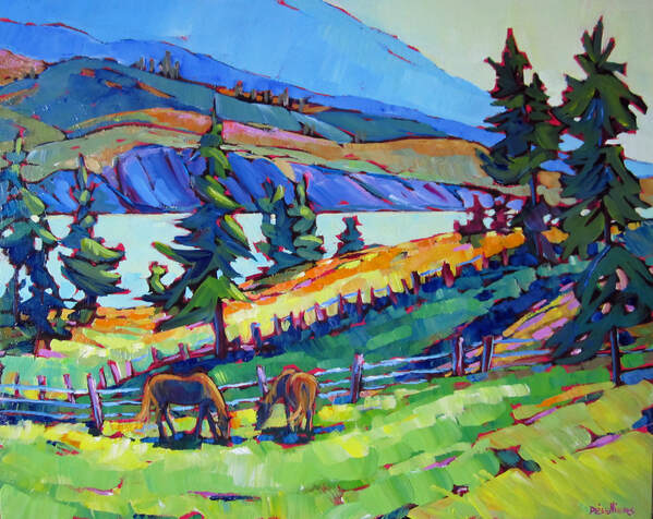
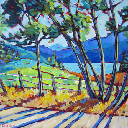
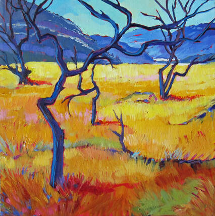
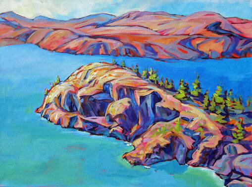
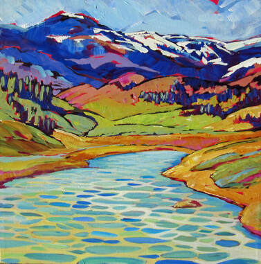
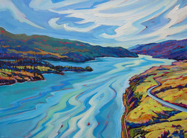
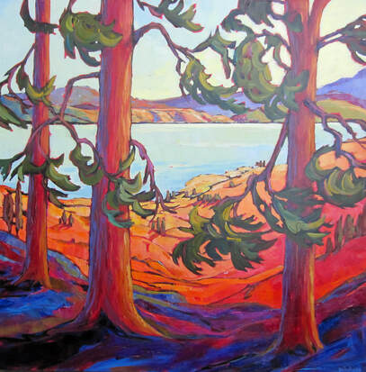
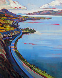
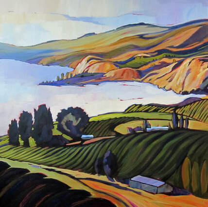
Our Lakes : Connecting the Dots.

Artistic Statement:
​
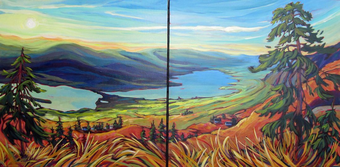
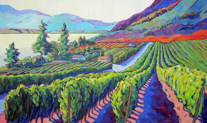
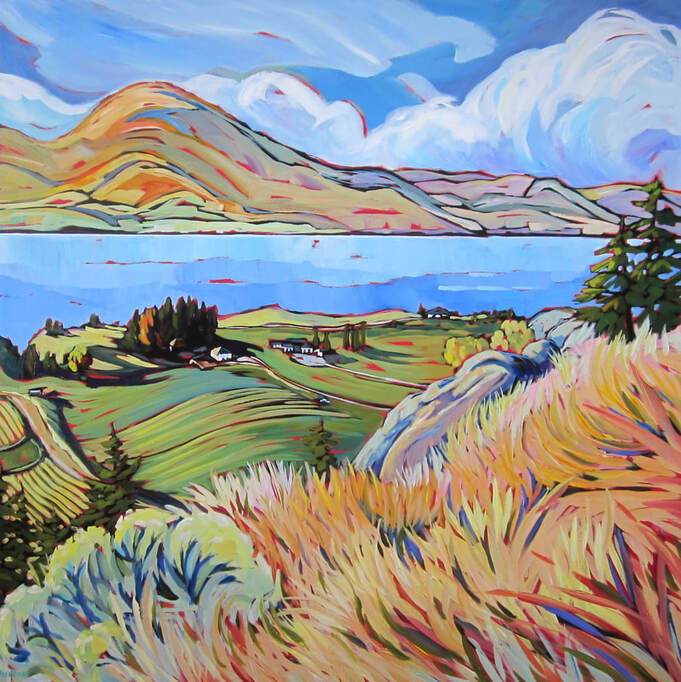
​​ What does “Our lakes: Connecting the dots” means? First, it’s about our lakes. The Okanagan basin lakes. These incredibly beautiful lakes and the creeks and rivers that regulate their levels. “Our” lakes because it’s not good enough to live here or visit the area and just enjoy looking at them. It’s another one of those privileges that comes with responsibilities. So, by saying “our” everyone can feel a bit of that connection which entails and demand care and stewardship.

“Connecting the dots” is born from the obvious connection that each lake has with its neighbors. What affects one lake will undoubtedly impact the others. But just as the animals, the vegetation, all living things within the geography of the area are all connected in a working ecosystem, there is another level of connection. That one has to do with our own connection to the lakes and to that ecosystem as well as each other. So many individuals who dedicate their time and efforts to work with others in order to keep these beautiful lakes as clean and productive as they can possibly be.
​
So this art show is about celebrating the beauty of the lakes within the Okanagan watershed but also celebrating the vision and positive impact that many groups have on the lakes. These groups are part of a network that connect them to each other’s and to the lakes. This is what I mean by it. Let the art and the beauty of this area inspire you to read about and join these groups in their efforts to make a difference every day. “Harnessing the power of Art to promote conservation” 
Picture
Above Giant's head 24x24 (sold)
Picture
Peace 8x8 $140 (sold)
Picture
Heading to the Peach 12x12 $230 (sold)
Picture
Ellison Lake 36x48 $2000 (sold)
osoyoospersists.ca/2021/04/01/virtual-gallery-painter-lyse-deselliers-opens-solo-show-at-the-art-gallery-osoyoos/​
​Geology
 
Okanagan lake as well as the other lakes in the valley were formed in part due to the Okanagan Fault which can be traced for at least 200 km and closely follows the Okanagan valley. This fault as well as the second one that creates the “knee bend” in the Okanagan lake exposed rock as old as 2 billion years such as McIntyre Bluff and was most active around 50 to 60 million years ago. This likely coincides with the volcanic activity that produced calderas in Penticton (like Munson Mountain), Summerland (Giant’s head) and West Kelowna (Mt. Boucherie) and Kelowna (Mt. Dilworth). Then, 1.5 million years ago the climate in the valley cooled down forming glaciers that were up to 2 km thick in places. Finally, around 12 to 15 thousand years ago, the glaciers retreated leaving a large block of ice filling the valley at McIntyre Bluff, blocking the flow of water coming from the watershed to the North, thus forming Glacial Lake Penticton. This huge lake was in place for at least 100 years until the ice dam at Vaseux opened up. We can still see its banks which were 100 meters above the present level of Okanagan Lake and form the silt bluffs upon which many vineyards are located.

​The area of the Okanagan Basin watershed is 6,187 square kilometers (1/3 the area of Switzerland). In 1970, a report raised concerns about water quality and quantity in the Okanagan Water Basin in relation to population growth. In response, the Okanagan Basin Water Board was instituted as a collaboration between the regional districts of North Okanagan, Central Okanagan and Okanagan- Similkameen to provide leadership on valley-wide water issues. In 2006, the board established the Okanagan Water Stewardship Council to provide technical advice. The council is made up of representatives all level of governments, the Okanagan Nation Alliance, local post-secondary institutions, agricultural groups, conservation groups and others.
The OBWB has a mandate to look into different issues affecting the Okanagan Water Basin and see how best to meet the needs (human, animal and fauna) in the Valley. From controlling Eurasian Watermilfoil and preventing introduction of invasive mussels to addressing septic pollution and dealing with toxic algae blooms, to optimizing water treatment plants and promoting water conservation, the Board has multiple programs on the go.

Picture
View from Anarchist Mountain 30x60 (sold)
Picture
Memorable image 36x60 $2,500 (sold)
Birgit Arnstein, Osoyoos Lake Water Quality Society
 
“We all need this lake to stay clean”. Those are the words of Birgit Arnstein, president of the Osoyoos Lake Water Quality Society (OLWQS). Birgit, who has always been involved in conservation, leads an awesome team of volunteers in charge, among other things promoting good lake stewardship and monitoring Lake Osoyoos water quality (i.e.: turbidity, temperature, dissolved oxygen, pH, etc. ). This monitoring is now conducted by volunteers from a new boat obtained via numerous grants and fundraising efforts. One of the issues Birgit is really concerned about is the threat of invasive aquatic species, such as the Asian clams that are currently found the U.S. end of Osoyoos Lake and in Shuswap Lake and the dreaded Zebra and Quagga Mussels that would devastate Osoyoos Lake if introduced into the Okanagan Basin. So far testing has found no invasive mussel larvae and the OLWQS continues to inform the public about preventative measures like the Clean-Drain-Dry (your boat and equipment) protocols in order to keep it that way. 

​Okanagan Lake
 
Stunning Okanagan Lake between four and five kilometers wide, is approximately 110 kilometers long from the north (Vernon) to the south (Penticton). Kelowna sits just about half way and the east and west sides of the lake are connected by the wondrous five-lane floating William R. Bennett Bridge.
There are just as many theories as to the derivation of the name of Okanagan and Okanagan Lake. One is that it means “rendez-vous” in the Okanagan-language as the head of the river at Lake Osoyoos is where First Nations of the area often gathered for an annual potlatch. One of the more likely explanations is that the name comes from "kana" meaning "the place of," and "gan" meaning "water" or "lake".
Okanagan Lake has been carved out by repeated glaciations and it is not uncommon for the depth to quickly change from 100 meters (m) in one spot, and 10 m in others. Being that the lake is glacier-formed; some parts of the lake bottom have up to 750 m of glacial and post-glacial sediment fill, which were deposited during the Pleistocene Epoch.
Okanagan Lake is better known for its beautiful beaches (with over 30 throughout the region) than for its winter skating. The last time Okanagan Lake froze over completely is up for debate. It is believed that the last time it froze across from shore to shore — and that's always the question — how deep was it frozen — was probably 1986 but the year that most people will recognize it freezing was the winter of 1968-69. 

Picture
Warm Winds 36x36 (sold)
Picture
Brian Spence and Lyse with the painting of Brian's plane. Thanks to my neighbor, I got to see the Okanagan Basin from above.
Picture
Iconic Gift commission
Picture
Bear's creek running 20x16 $525 Framed (sold)
Corinne Jackson, Okanagan Basin Water Board
 
“A lot of us were drawn here by the water” says Corinne Jackson, Communication Director with the Okanagan Basin Water Board. “But what’s not really well understood is the Okanagan has less water available per person than anywhere in Canada and has one of the highest rates of water use per person in the country. As our population increases and we face increasing changes to our climate, we are on an unsustainable path unless we take these waters seriously and work to protect them”. The Okanagan Basin Water Board (OBWB) was initiated in 1968 (legislated in 1970) as a valley-wide partnership to identify and resolve critical water issues in the Okanagan watershed.
 
The Board of Directors includes representatives from the three Okanagan regional districts, the Okanagan Nation Alliance, the Water Supply Association of BC and the Okanagan Water Stewardship Council – a multi-stakeholder group established by the Board to provide independent science-based advice on water issues.
 
“The Board is looking, among other things, at how to meet all the needs for water in the valley – for food, for fish and the larger ecosystem, for people. But a myth of abundance persists here” says Corinne. “After agriculture, the second largest use of all our water is on our household lawns and gardens. When considering our own yards, we encourage people to look to the hills for inspiration and to plant for our dry climate.” Not only does the OBWB have concerns about water quantity but also about water quality, including concerns about invasive species (invasive mussels and plants like milfoil), as well as nutrients like fertilizers entering waterways which can create toxic algae blooms, and backcountry and lake activities that can impact waterways.
Their website obwb.ca outlines some of the challenges this valley faces including climate changes and lists research and solutions that are being implemented to deal with water issues in the Okanagan basin. Corinne and her team are very dedicated in spreading the word about these issues and advocating for solutions rooted in science. Residents can also find information on ways to be WaterWise at home, in business, in schools and in the community, on the OBWB’s public outreach and education website, okwaterwise.ca.


Brian Spence, Cessna float plane owner and pilot
 
“People are really good about not spilling gas; it’s too expensive to waste!” Brian says with a good laugh. Brian Spence is a true lake enthusiast. Not only is he very careful while filling his float plane’s gasoline tank, he’s just as careful with his water-skiing boat.
Brian has seen the quality of the water improve since he was a kid. Swimming, stand up paddling, kayaking, sailing, water-skiing, from the air or in the water, he knows the lake very well. He knows like many local residents how fortunate we all are to be living in the Okanagan and he doesn’t take the lakes for granted. Brian was kind enough to take me (the artist) up in his float plane for a view of the area. Thanks to him, I was able to paint a bird’s eye view of the area.
 
Picture
Elder's dream 16x20 (donated to ONA)
Picture
Following the Salmons 12x12 $230 (sold)
Picture
Sharing the land 16x16 (sold)
Picture
Long journey 12x12 $230
Picture
Living creek 20x16 $500 (sold)
​Proceeds of the 5 paintings above will go to the the En'owkin Centre's ECOmmunity Program. 
​
Ryan Benson, Okanagan Nation Alliance
 
  “Salmon was very important to Syilx culturally and spiritually.  There are 4 food chiefs, one of them is ntytyix or spring Chinook.  He is the chief of all fish and anything that lives in the water.  The four food chiefs are very important in Syilx culture. Also, salmon were extremely important to the Syilx economy.  The elders tell stories of historic trade networks to the coast and as far east as Blackfoot territory on the plains. So, the loss of salmon in the 20th century was a profound and devastating loss to Syilx.  The return of salmon truly impacts the Syilx community, particularly the Elders who still have memories of the salmon from when they were children” writes Ryan Benson, Fisheries Biologist with the Okanagan Nation Alliance (ONA). The leadership of the ONA in bringing Sockeye Salmon back to the Okanagan basin is remarkable. From the mid 1990’s when Elders became very concerned about the very low numbers of spawning Sockeyes in the Southern Interior, to 2020 when up to 25,000 adult Sockeyes were estimated to have reached Skaha lake, this success took a lot of collaboration between the Okanagan Nation Alliance and both the federal and provincial governments.
 
 For this program to be so successful, many things had to happen, from the scientific research at the beginning of the project in 2003 to the opening of the Fish Hatchery in Penticton in 2014 to the multi-year monitoring of fish within the Okanagan basin, and to the recent installation and opening of fish ladders in dams such as the Penticton Dam. When asked what this project meant to him, Ryan said “I told my boss that this was a career highlight” referring to when he finally got to open the fish ladder in the Penticton Dam in 2019. Now using telemetry (with microchips) he’s able to follow the adult Salmon swimming north all the way to Vernon.
 
This project not only took dedication and vision but also required open communication among First Nation Bands and Tribes, various governmental agencies and even among countries. Sockeye salmon start their journey in the tributaries of Osoyoos and Skaha Lakes but when they are 1 year old, they swim south into the Okanagan River and the Columbia River in Washington State to eventually reach the Pacific Ocean. After living for three years in the ocean, migrating all the way up to Alaska, the Sockeye Salmon then start their travels back to the mouth of the Columbia River, swimming all the way back to their spawning areas such as the Penticton Channel.  This is a remarkable journey for the Salmon and a remarkable success in conservation. 

Healthy creeks and flood plains
 
“The En'owkin Centre's ECOmmunity Program is currently partnered with the Okanagan Nation Alliance (ONA) Fisheries Department and the Penticton Indian Band to restore salmon fry-rearing habitat (mostly for Chinook Salmon) beside the Penticton River Channel as part of our collaborative floodplain re-engagement project” writes Michael Bezener, biologist and ECOmmunity Program Manager. This innovative project is an effort to recreate a portion of the ancestral floodplain of the Okanagan River to support recovery of endangered Okanagan Chinook Salmon populations, replenish species of cultural significance to syilx (Okanagan) people, and help recover many other populations of species at risk in need of our help including the Yellow-breasted Chat, Western Screech-Owl, Lewis's Woodpecker, Blotched Tiger Salamander, Great Basin Spadefoot, Little Brown Myotis, and Monarch butterfly. By re-engaging the floodplain to the flow of the Penticton Channel, and by replanting the surrounding lands with indigenous trees, shrubs, flowering plants, and grasses, Chinook salmon fry born in the adjacent river channel will find everything they need to grow into strong and healthy smolts capable of making the journey to the Pacific Ocean via the Okanagan/Okanogan and Columbia rivers. Chinook Salmon, known as ntytyix in the n'sylxcən language of the syilx (Okanagan) people, is revered as the Chief of all water creatures.
 This is done in an effort to recreate a portion of the ancestral flood plains bordered by indigenous plants to allow young Chinook salmon to grow once they hatch.  Different populations of Chinook salmon use either beaches or creek beds to lay their eggs. Kokanee (or kickinee in the n'sylxcən language), which are land-locked Sockeye Salmon that live out their entire life cycle in freshwater (they spawn in creeks, rivers or rocky/gravel lakeshores), unlike anadromous Sockeye Salmon and Chinook Salmon which are born in freshwater and grow in freshwater rivers and creeks from the fry to smolt stage before migrating downstream to the ocean. After spending ~3-4 years growing in the ocean, ana Sockeye Salmon and Chinook Salmon migrate back upstream to the freshwater rivers and creeks where they were born in order to spawn then die.

​Follow the Salmons
 
The ONA  started releasing Sockeye Salmon fry in the Okanagan lakes and river system in 2004 and opened the Penticton Indian Band Fish Hatchery in 2014. Fast forward to today, we are now looking at Sockeye Salmon now reaching Okanagan Lake. The Salmon now travel all the way    way to Vernon bypassing the Okanagan Falls Dam, the McIntyre Dam and the Okanagan Dam in Penticton via fish ladders. A record 25,600 spawning adults Sockeye Salmon were found in Skaha Lake as evaluated using Passive Integrated Transponders which are like little microchips. The ONA and its fish hatchery released a record 3.5 million fry in Okanagan Lake last year (2020). So, thanks to their constant efforts and monitoring, the future is brighter for Sockeye Salmon in the Okanagan Basin.

Picture
Antilope brush at Tuc-el-Nuit 24x48 (Sold)
Picture
On my side 10x10 $200 (sold)
Picture
Southern winds 12x12 $230 (sold)
Picture
Majestic McIntyre Bluff 30x36 $1,250 (sold)
Picture
Elemental (Wood lake) 36x36 (sold)
Richard  Cannings, Member of Parliament (MP)
 
When asked the impossible question of which lake he prefers in his South Okanagan–West Kootenay riding, MP Richard Cannings cannot choose among the many special places within his riding. When pressed, he eventually offers: “Vaseux lake is so precious as a wilder place with natural habitat and it has spectacular diversity”. As a biologist (BC’s Biologist of the Year in 1996) Richard has spent his life working tirelessly to protect BC’s environment. Richard brought this commitment to Ottawa in 2015 when he was first elected Member of Parliament. His love for birds goes beyond his work with Bird Studies Canada, the Nature Conservancy of Canada or writing books about them. He stills counts them each year and post his impressive exploits online! Richard has been involved for years with the Vaseux Lake Bird Observatory (VLBO) which is a project of the Okanagan Similkameen Conservation Alliance (OSCA).
In collaboration with the Canadian Wildlife Service (CWS), which provides the majority of the funding for the project, VLBO started in 1994 and has been operating as a migration monitoring station at its current location on Vaseux Lake since 2001, making this the 20th consecutive year of monitoring. VLBO is a member station of the Canadian Migration Monitoring Network (CMMN) which is a subsidiary of Bird Studies Canada that oversees all 25 migration monitoring stations in Canada by providing protocols and standards, pooling data, and offering opportunities for networking and collaboration. One of eight active stations that monitor avian migration in British Columbia, it is the only one in the dry Southern Interior region. Monitoring bird populations is very important work as there has been a loss of 3 billion birds in the past 50 years worldwide. A huge thanks to Richard and all the staff and volunteers who get up before dawn to count the birds that live or migrate in this beautiful region!
Richard reminds me that “the Okanagan basin is one of the smallest watersheds in Canada with more people per acre of watershed, which means little precipitation for a lot of people”. Climate change and water scarcity is just one of the concerns the MP has. “There has been a deterioration of the riparian (shoreline) habitat with a loss of 80-85% of the wetlands mainly in the past 80 years. Also invasive species are a big concern”. He even goes as far as saying that the Federal Government should increase the staff at the Department of Fisheries and Oceans (DFO) to work in the Interior BC. Right now there is only one DFO person doing that job, and monitoring needs to be enhanced for invasive species such as the Quagga and Zebra Mussels, especially at the Osoyoos border.

​Vaseux Lake
 
The name "vaseux" is French, meaning muddy or murky, which is descriptive of the lake's silty water. The lake was likely named by French Canadian fur traders.
The town of Okanagan Falls is to the north, and the town of Oliver is to the south of the Vaseux Lake. The lake stage is controlled by McIntyre Dam.
Vaseaux Lake features a variety of wetland and foreshore habitats that support large populations of migratory bird species along the inland portion of the Pacific Flyway. Bird species of note include the Trumpeter Swan, Great blue Heron, Western Screech-owl, Yellow-breasted Chat, and the Red-listed Lewis’s Woodpecker. It is for these reasons that the Canadian Wildlife Service designated the lake and its foreshore a Migratory Bird Sanctuary in 1923. The semi-arid grasslands and forests surrounding the lake are also of ecological importance, and are protected within several different national and provincial protected areas. In 1956, the provincial government established Vaseux Lake Provincial Park at the northeastern end of the lake to provide space for recreation while also preserving the ecological integrity of the lake's foreshore. In 1979, the Canadian Wildlife Service established the Vaseux-Bighorn National Wildlife Area to protect winter rangeland for California Bighorn Sheep. The provincial government added on to this nature preserve by establishing Vaseux the Protected Area in 2001.
Vaseux Lake Bird Observatory is located on the west side of Hwy. 97, one kilimeters north of Vaseux Lake and four kilometers south of Okanagan Falls, BC.  It is part of the Canadian Migration Monitoring Network.  The Canadian Wildlife Service monitored migration at a site at the north end of Vaseux Lake from 1994 to 1998.  After a two-year hiatus, the station was revived by the Okanagan Similkameen Conservation Alliance and moved one  kilometer north because of changes to the initial site.  It is located on land owned by Environment Canada (Vaseux Bighorn National Wildlife Area) and by the BC Ministry of Environment.  Species commonly sampled are Orange-crowned Warbler, Gray Catbird, Song Sparrow, Willow Flycatcher, “Audubon’s” Warbler, and Common Yellowthroat.  The station operates every morning from August 1 through October 15.  Migrants are sampled through banding (with 14 mist nets), a daily census, and general observations.


Picture
Falling in love with the land 16x20 (sold)
Picture
One way ticket 16x20 (sold)
Picture
Fall upon us 36x48 $2,000 (Sold)
Picture
Unique WR Bennett bridge 16x20 (sold)
Picture
Floating by 16x20 $525 Framed (sold)
Okanagan winery industry history
 
The first vineyard planted in the Okanagan was at the Oblate Mission in Kelowna in 1859, planted by French Catholic priest Charles Pandosy and was solely intended for the production of sacramental wine for the celebration of the Eucharist. Several small vineyards, planted mostly with Vitis labrusca operated until prohibition in the United States in the 1920s which encouraged the uprooting and replanting with other agricultural crops.
For most of the 20th century after prohibition ended in 1933, what limited wine production that took place in the Okanagan was mostly fruit wines made from berries, apples, cherries or even table grapes. One winery, Calona Wines founded in 1932, still remains from that period and was the first commercial winery in British Columbia. It remains the oldest continuously running winery in the province. Eventually the use of French-American hybrid grapes, such as Marechal Foch and Vidal blanc took hold, led by the Stewarts of Quails' Gate Estate Winery.
In the mid-1970s, several growers began experimenting with plantings of Vitis vinifera. The Osoyoos Indian Band established the first commercial vineyard dedicated to vinifera varieties with plantings of Riesling, Ehrenfelser and Scheurebe. In 1976, notable German viticulturalist and grape breeder Helmut Becker visited the Okanagan and encouraged more growers to consider planting German grape varieties. He provided clones of Pinot blanc, Pinot gris and Gewürtztraminer that were developed at the Geisenheim Grape Breeding Institute and bred to withstand the cold, winter temperatures of the Okanagan.
Further impetus for the planting of vinifera came in the late 1980s when Canada entered into the North American Free Trade Agreement (NAFTA) that opened up the Canadian markets to American wines from California, Oregon and Washington. The competition from imported wines spurred the Canadian government to implement a vine pulling scheme with grants for growers who uprooted their hybrid and labrusca vines and replaced them with vinifera.
​
People in the Okanagan valley
 
The population of the region was 362,258 according to the 2016 Canadian federal census. The three regional districts within the Okanagan and their populations were: Central Okanagan (194,822), North Okanagan (83,022) and Okanagan-Similkameen (84,354).
But with Kelowna having the fourth highest growth rate in Canada and a population of 220,000 in 2020, it’s clear that the region is going to be challenged by the pressure such population growth will put on the Basin’s water resources. Add to this tourism, which before Covid-19 reached 3.4 million visitors to Osoyoos, Penticton and Kelowna combined, the necessity to pay close attention to our water usage, and the demands of our increasing human population, becomes abundantly clear.     


Picture
A stroke of luck 36x36 (Sold)
Picture
Christie's falls 20x16 $500
Picture
Flying south 24x24 (Sold)
Picture
Clarity (Skaha lake) 24x48 (sold)
Picture
State of grace 36x36 (Sold)
​
Skaha Lake

 
Skaha Lake was originally labelled “Lac du Chien” (Dog Lake), then changed in 1930 to Skaha "to agree with the local name," as stated by the BC Chief Geographer at the time. However the Okanagan First Nation says "skaha" is not their word for dog, but rather that of the Shuswap Nation, and that the local word for dog is “chokowapee”.  Another spelling is kaekuwapa. The local meaning of skaha is "horse".
Approximately 12 km long and 2 km wide, in comparison to Okanagan Lake, it's neighbor, it is much less overwhelming if you're not used to being out on large bodies of water.
The Skaha Lake depth is about 54 meters (177 ft).  Skaha is a popular wind surfing and kite surfing lake, particularly at the north end which borders the city of Penticton. On any given windy day, it's a delightful show of colorful kites, cutting the waves and flying about the shore of Skaha beach. Apparently, kite surfing on Skaha is “epic” according to Morgan, a lakeshore resident, who lives for those windy fall days.
People also love to swim the warm (23 C) fresh water of Skaha, and some actually swim the whole length of 12 km during The Skaha Lake Ultra Swim, an annual event on the lake. 

​Richard Nickel, retired biologist, B.C. Ministry of Environment
 
“There was chaos at one time, no money, no plan”. That’s what biologist Richard (Dick) Nickel saw in the early 80’s after he was transferred to the Okanagan while working for the B.C.’s Ministry of Environment. “A lot of people were concerned back then” says Dick. Back then there were Blue-green algae (cyanobacteria) in shallow areas of Skaha Lake where people swam. Eurasian Milfoil, an invasive aquatic plant, formed a blanket along the Skaha lakeshore properties. There were the runoff from agricultural lands and sediments from forestry operations.
 
And at the time Penticton was endeavoring to remove nutrients with antiquated systems and limited success, like other small Okanagan municipalities with similar practices filling the lakes with nutrients.  There were also large areas of development not connected to regional sewer systems that had impact on the lakes. Kelowna, on the other hand, had just completed a new waste water treatment plant that was technically innovative for removing nutrients so had made progress and their lead was eventually followed by other municipalities including Penticton and what is now the City of West Kelowna and Municipality of Summerland. 
 
Dick and his small OK Water team went to work and developed a strategy which was presented to the various ministries (health, forestry, municipal affairs, and agriculture) and to elected officials. Funding was secured to develop and implement a variety of infrastructure projects including municipal waste water operations. With a clear vision of what the issues were and what needed to be done, the team obtained the cooperation of the various stakeholders and saw the implementation of these solutions which have led to a dramatic improvement of the Okanagan lakes water quality. “Fortunately we were able to work with all the municipal entities and generally limit nutrients and protect the quality of the lakes” says Dick. Now 40 years later, Dick can ponder the delicate balance of the health of the Okanagan lakes while paddling in sync on Skaha lake with his Dragon boat’s teammates. Different times, different team, same cooperation. 

Picture
Pasture land 16x20 $525 Framed (sold)
Picture
Wind effects 12x12 (sold)
Picture
The way of the Apricots 16x16 $360 (sold)
​Agriculture
Boasting 84% of the province’s vineyard acreage, the Okanagan Valley is BC’s premier grape growing region. With an ever-changing panorama, the valley stretches over 250 kilometres, across sub-regions, each with distinct soil and climate conditions suited to growing a range of varietals from sun-ripened reds to lively fresh and often crisp whites.
The Okanagan Basin has a continental climate that is moderated by the deep Okanagan Lake and its connected bodies of water in the valley: Skaha Lake, Vaseux Lake and Osoyoos Lake. The Cascade and Coast Mountains create a rain shadow effect shared by adjoining areas of Eastern Washington. This leaves the Okanagan with low annual precipitation totals that range from below 250 millimetres (9.8 in) in the southern tip of the region around Osoyoos to 400 millimetres (16 in) in the northern part of the region between Kelowna and Vernon.
Warmer and more arid than Napa Valley, the Okanagan Valley gets nearly two hours more sunlight per day during the peak growing season. This means most vineyards require irrigation from nearby water sources. Like many wine regions with continental climates, the Okanagan may experience winters that are moderately cold, but generally short-lived. During extreme cold snaps, temperatures can fall as low as −25 °C (−13 °F), but the last winter to cause severe cold damage to vines was 1978.
The average daytime temperatures during the growing season months of July and August are hot, often above 30 °C (86 °F) in the southern valley to high 20s°C (68°F) in the northern valley. Temperatures may surpass 40 °C (104 °F), often exceeding 35 °C (95 °F) for several days in a row. The region's northerly latitude allows the vines to experience longer hours of daylight than the more southerly vineyards of California, with the Okanagan summer providing some 14 hours daily of direct sun.
Picture
Rattlesnake point Kalamalka 18x24 $540 Framed (sold)
Picture
Spotted lake, phenomenal 16x16 (sold)
Picture
Flowing through Kalamalka 18x24 $540 Framed (sold)
​Al Peatt, Love Your Lake
 
 “It’s like connecting the dots, a healthy lake needs healthy shorelines” says Al Peatt, Southern Interior Land Trust (SILT) Executive Director.  SILT brought the “Love Your Lake” program to BC for the first time in 2019. Love Your Lake received its funding through the South Okanagan Conservation Fund.  “We wanted assurance that somebody was out there to create these stepping stones in nature conservancy”. These “stepping stones” Al is talking about are all the lakeshore properties that line the Okanagan basin lakes. In a perfect world, Al would love to have approximately 75% of the shoreline natural and 25% for the property owner own use. “There is a loss of natural vegetation, whether that's native vegetation or planted landscaping, and with floods in recent years, it's resulted in a move to really doing some hard engineering on the shorelines to protect those properties (like retaining walls), but there are other methods out there that are as effective or not more effective”. The Love Your Lake website shows how some property owners have, on a volunteer basis, transformed their shoreline using logs, rocks and native tree/shrub plantings to not only stabilized the shore and prevent erosion but also to contribute to the  enhancement of the quality of the water and their lake ecosystem.
 "Our suggestions that we make are geared toward plants that are native that can be used to frame views, stabilize shores and the shoreline, and the best part is not only are they beautiful but they can be pruned low so that the views can be maintained and enhanced ... this is a method to jumpstart voluntary stewardship that will benefit all residents in the Valley."
Property owners in the survey areas (i.e. Summerland, on Vaseux Lake and Skaha Lake) have been mailed a personalized letter with a unique download for their free report. Al is hopeful the tips, which are not mandatory, will be taken to heart and implemented as the win-win tools that they are meant to be. Thanks to Al and his team, each of the lake property owners can do their part in preserving the health of their lake; for themselves, their children, the fish, the animals, the plants, and all who benefit from a healthy lake. 

Kalamalka Lake

 
The lake is named after the Okanagan First Nation Chief Kalamalka whose people occupied its northern shores. Okanogan is its U.S. spelling. Kalamalka Lake is one of only a few incredibly rare and unique 'marl lakes.'  A marl lake has a large amount of calcium carbonate (CaCO3) deposits present which changes the colour of the water vibrant green as the water temperature increases in the spring and summer.  1.5 million years ago the climate in the valley cooled down, forming glaciers that were up to two kilometers thick in places. Around 12 to 15 thousand years ago, the glaciers retreated in the region, leaving behind these limestone deposits that give Kalamalka Lake that alluring tropical green hue. As the water temperature drops again later in the year, the calcium carbonate is dissolved and so too goes the stunning green that comes with it, but you can still see some remaining green spots even in the winter
Picture
My Okanagan II 36x36 $1,500 (sold)
Picture
Free as a bird 20x16 (sold)
Picture
It's going to be alright 36x36 (sold)
​Swimming Okanagan Lake
 
Thinking of swimming the whole length of Okanagan Lake?  Why not! Adam Ellenstein, a 39-year-old Michigan endurance swimmer proved it can be done. He completed the gruelling swim of the entire the length of Okanagan Lake in July of 2016. Ellenstein wanted to create an event that would advocate the importance of exercise in the lives of people like his aunt Susan, living with Parkinson's disease.
“When I could, I shut down my mind and body and lived in the empty spaces between the thoughts,” he said. “You can be swimming for two or three hours and it feels like 10 or 15 minutes.” Ellenstein began his 106.6-kilometre swim just before 6 a.m. starting in Vernon on a Monday and landing at the beach in Penticton at 10:46 p.m. the following day Tuesday, clocking in at 40 h 57 m 11 sec, successfully setting a Guinness World Record for fastest, continuous lengthwise swim of British Columbia’s Okanagan Lake.  “It was an especially special experience,” he said.  “The people and the energy and the spirit in this valley are quite special.”
In 2015, the year before Ellenstein record breaking swim, Peachland resident Shayn Moritz decided to swim the lake from end to end to celebrate his 50th birthday. Moritz completed the task in seven days, and used sheer stamina to achieve his goal. Perhaps, for most serious swimmers, crossing the width of the lake instead appears more reasonable. The “Across The Lake Swim” began in 1949 and is the longest running and largest annual open water event in Canada attracting over 1,200 swimmers every year who come to Kelowna to swim the 2.1 kilometer distance across Okanagan Lake.


Powered by Create your own unique website with customizable templates.
  • Home
  • Gallery
  • About
  • Contact
  • Blog
  • Events
  • Our Lakes : Connecting the Dots